


![]()
Trimble MX8 Land Mobile Mapping System
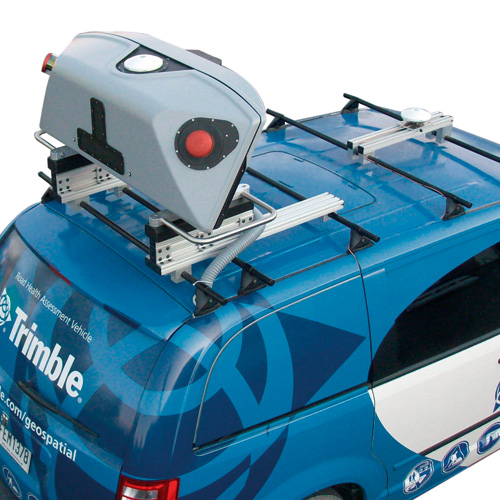
The Trimble MX8 is a premium mobile spatial imaging system capturing fully synchronized, high-quality georeferenced point clouds and high-resolution imagery. The vehicle-mounted system is designed for surveyors, engineers, and geospatial professionals conducting as-built modeling, inventory, inspection, encroachment analysis, and asset management for roadways, bridges, railway, utilities and other infrastructure management.
Features
- Performance 360-degree mobile dual laser scanners collecting over one million points per second
- High-frequency digital cameras at set orientations capturing high resolution panorama and surface imagery
- Market-leading POS LV positioning and orientation system delivering extremely fast position updates (up to 200Hz) and high accuracy results even when GNSS signals are interrupted
- Rigidly mounted and fully calibrated pod with wide navigation and sensor base for easy installation on a variety of vehicle types
- Trimble Trident software to extract survey, GIS and construction deliverables